Location
FAA Identifier: 8NC9
Lat/Long:
35-18-26.0000N 082-26-01.0000W
35-18.433333N 082-26.016667W
35.3072222,-82.4336111 (estimated)
Elevation: 2083 ft. / 635 m (estimated)
Variation: 05W (1995)
From city: 1 mile SE of HENDERSONVILLE, NC
Time zone: UTC -4 (UTC -5 during Standard Time)
Zip code: 28792
Airport Operations
Airport use: Private use. Permission required prior to landing
Activation date: 06/1999
Control tower: no
ARTCC: ATLANTA CENTER
FSS: RALEIGH FLIGHT SERVICE STATION
Attendance: IREG
MUSEUM OPEN WED, SAT, SUN 1200-1700.Wind indicator: yes
Segmented circle: no
Airport Communications
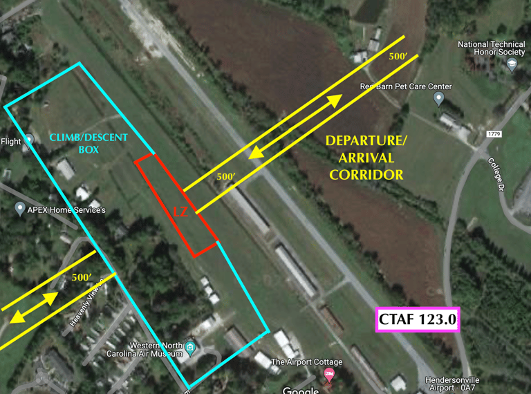
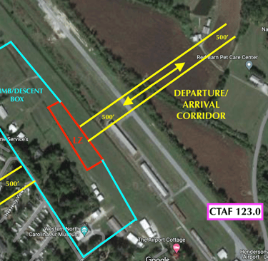
UNICOM: 123.0
Communications appended by "Landing Johnson Field" (8NC9) or "Landing Hendersonville" (0A7) as appropriate
WX ASOS at AVL (9 nm NW)
PHONE 828-681-0131
Nearby radio navigation aids
VOR radial/distance VOR name Freq Var
SUGr236/10.0 SUGARLOAF MOUNTAIN VORTAC 112.20 02W
SPAr305/29.8 SPARTANBURG VORTAC 115.70 02W
NDB name Hdg/Dist Freq Var ID
BROAD RIVER0 49/2.8 379 07W BRA -... .-. .-
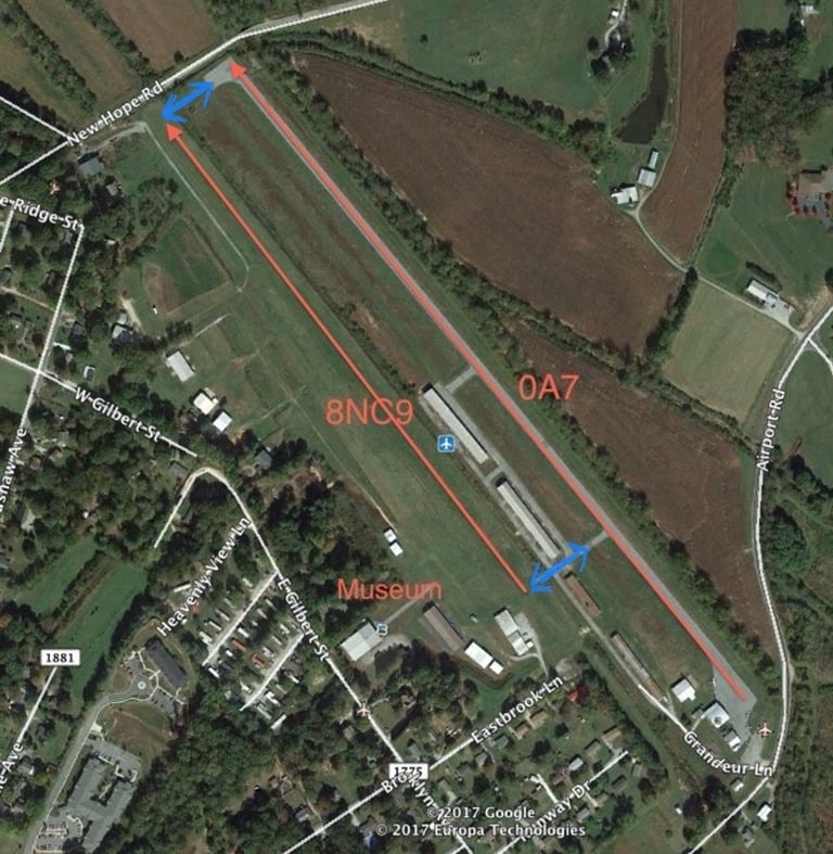
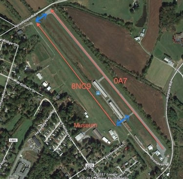
Pattern and Runway Information
Runway 15/33
Dimensions: 2400 x 100 ft. / 732 x 30 m
Surface: turf
Pattern Altitude
Aircraft - 1000AGL
Fixed Wing Ultralights - 500AGL
RUNWAY 15 RUNWAY 33
Traffic pattern: left left
Obstructions: none 75 ft. trees, 300 ft. from runway
Airport Ownership and Management from official FAA records
Ownership: Privately-owned
Owner: Western North Carolina Air Museum
1340 Gilbert Street, Hendersonville, NC 28739
Manager: Western North Carolina Air Museum
1340 Gilbert Street, Hendersonville, NC 28739
Additional Remarks
HENDERSONVILLE ARPT LCTD 500 FT EAST OF ARPT. CROSSOVERS AVBL, OWN RISK.
FOR CD CTC ATLANTA ARTCC AT 770-210-7692.- PPR, CALL 828-693-4317.
Instrument Procedures
There are no published instrument procedures at 8NC9.
Some nearby airports with instrument procedures:
KAVL- Asheville Regional Airport (9 nm NW)
KFQD- Rutherford County Airport/Marchman Field (25 nm E)
KGSP- Greenville Spartanburg International Airport (27 nm SE)
KGMU- Greenville Downtown Airport (28 nm S)
KLQK- Pickens County Airport (33 nm SW).